About Azores
THE AZORES
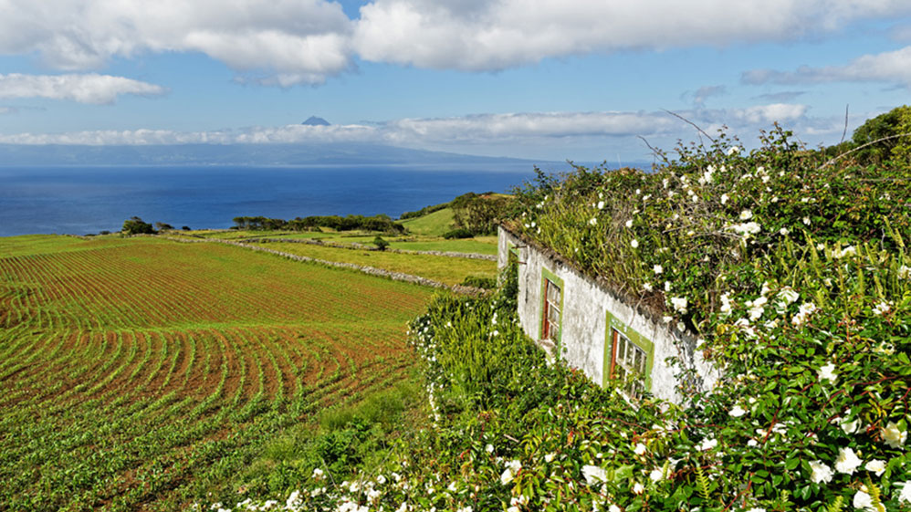
In the middle of the Atlantic Ocean, about a thousand miles away from Lisbon, are the 9 islands of the Azores, namely Sao Miguel, Terceira, Faial, Flores, Pico, Sao Jorge, Santa Maria, Graciosa and Corvo.
Every member of the volcanic origin archipelago -a territory of Portugal- is a masterpiece of nature, a true paradise for nature lovers: green fields, blooming hillsides, volcanic craters, rocks, crystal-clear air, lakes, lagoons and, of course, the wealthy ocean life.
Because of the Gulf Stream the climate is very pleasant; the average temperature during summer time is 22°C and around 14°C in the winter.
Thanks to the ideal all-year-round weather, pineapple, tea and even tobacco are grown across the archipelago.
It is difficult to discover all the beauty these islands have to offer; therefore, we are offering a great variety of holidays allowing you to explore the Azores step-by-step (or all-in-one go) and the opportunity is always there to return for more…
9 ISLANDS – 9 WORLDS
SANTA MARIA ISLAND
– The Island of the Sun / Yellow Island –
(due to the predominance of broom (Cytisus striatus) on its slopes, in addition to great aridity of the shrub like lower land and coastal vegetation in the summer)

Santa Maria is the oldest island of the archipelago, 17 kms long, 9.5 kms wide at its widest and with an area of 97 sq. kms. It was here where Christopher Columbus sought refuge in 1493 on his return from his voyage to America.
Santa Maria is different from the other islands as it is flatter and much dryer, warmer and with a lower humidity. The west, being the flatter area of the island, has higher temperatures and low growing vegetation. The central mountainous area and the rest of the island are more heavily wooded (with many endemic plants) with high cliffs and hillsides plunging into the ocean. To the south is Praia Formosa, one of the best beaches of the Azores and the Baia da Praia nature reserve.
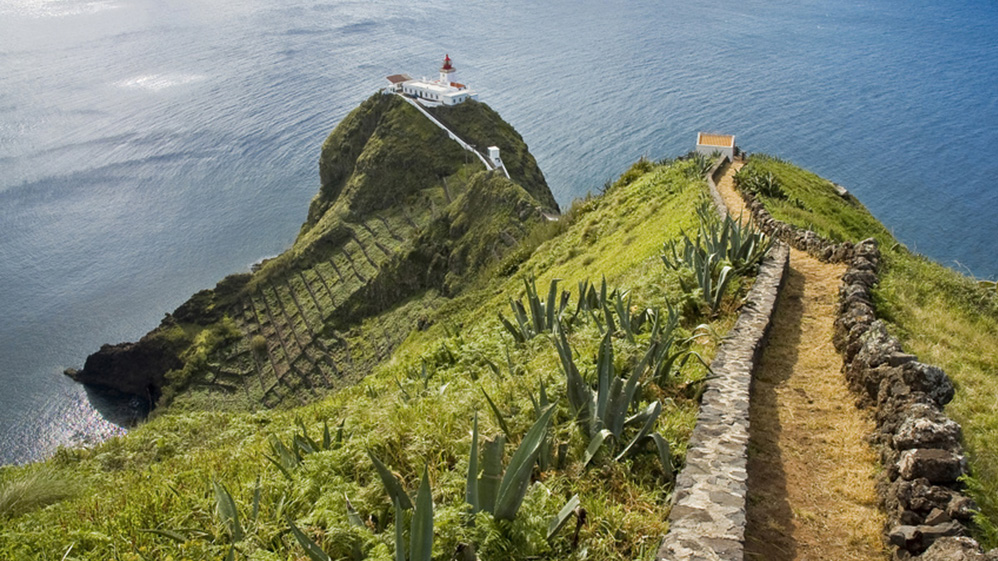
There are wonderful exploratory itineraries around the island. Anjos, where Columbus disembarked, the quaint town of Sao Pedro, the white Algarve style houses of picturesque Santa Barbara in the forested north and Pico Alto (590 metres) from where one can see the whole island. The 15th century town of Vila do Porto is the oldest in the Azores and has long streets leading to the 16th century cliff top fort of Sao Bras with the port below.
At the tiny village of Maia, the steep hillsides leading down to the ocean have been terraced with black volcanic rocks over many generations to hold the fertile soil in place to grow vines, wheat and corn. An imposing waterfall 110 metres high, called Cascata de Aveiro, deserves a few minutes of contemplation. There are also the Baia de Sao Lourenco, Ilheus das Formigas and Baia da Maia nature reserves – wonderful places to explore.
On the north side of the island, you can find a vast barren ground, Barreiro da Faneca, known as the “Red Desert of the Azores”, where long ago the adobe was extracted and was used as important economic activity of the island of Santa Maria, being also exported to other islands of the Azores.
It is a unique landscape in the archipelago, derived mainly due to one strong erosion, becoming an “ex-libris” of the landscape of Santa Maria.
Santa Maria has deposits of “Mio-Pliocene Fossils”. Their scientific importance led to the creation of the Regional Nature Reserve of Figueiral and Prainha in 2005. The sedimentary rocks, which preserve the fossils of many marine organisms that once inhabited the seas around Santa Maria, can be admired at the Dalberto Pombo Environmental Interpretation Centre, in the heart of the historic centre of Vila do Porto.
SÃO MIGUEL ISLAND
- The Green Island –
(due to the vast meadows and green forests that cover most of the island)

Sao Miguel, located on the eastern side of the archipelago, is by far the largest of the nine islands measuring 65 kms long, 14 kms at its widest and with an area of 750 sq. kms. It is made up of 6 volcanic complexes and municipalities:a most beautiful and varied island, ideal for long stays.
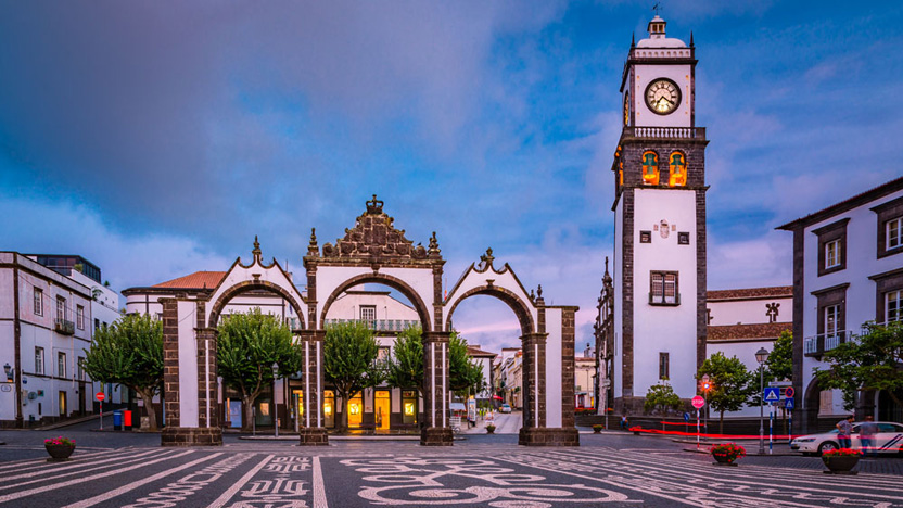
To the west of the island, Ponta Delgada, seat of the regional government, the main town and port have preserved its historical beauty. It is a delight to explore the narrow-cobbled streets bordered by very well-preserved period houses. Within this municipality are the Sete Cidades, an extinct volcano crater of 40 sq. kms, within two magnificent lakes, which are the green and blue lakes.
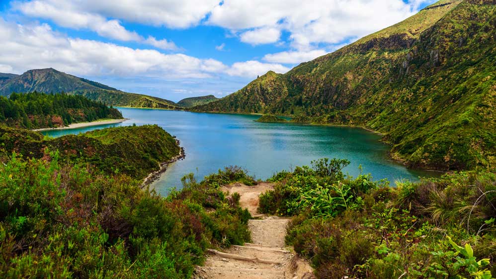
To the north of the island lies the agricultural town of Ribeira Grande, surrounded by fertile lands yielding crops which include potatoes, tobacco, sugar beet, passion fruit and tea (the only place in Europe where it is grown). The dramatic Fire Lake “Lagoa do Fogo” and delightful beaches nestling under high cliffs can be found here as well.
The north-east coast is a very special and relatively undiscovered region with spectacular high cliffs plunging from high, flower covered plateaux, fields and wooded mountains into the sea. This is the home of the rare Azorean Bullfinch.
The municipality of Povoacao is in the south-east, hosting the most beautiful gardens in the Azores. The spa town of Furnas, one of the largest thermal water sources in the world, with its beautiful two-kilometres square lake bordered in azalea, is home to a 30-acre botanical garden of great international importance. Everywhere, from April to early summer, hedgerows of azaleas and hydrangeas abound.
To the south of Sao Miguel, the municipalities of Vila Franca do Campo (the town was the island’s first capital) and Lagoa are mountainous, agricultural and farming areas with black cliffs disappearing into the ocean. Here pineapples, bananas and oranges are cultivated.
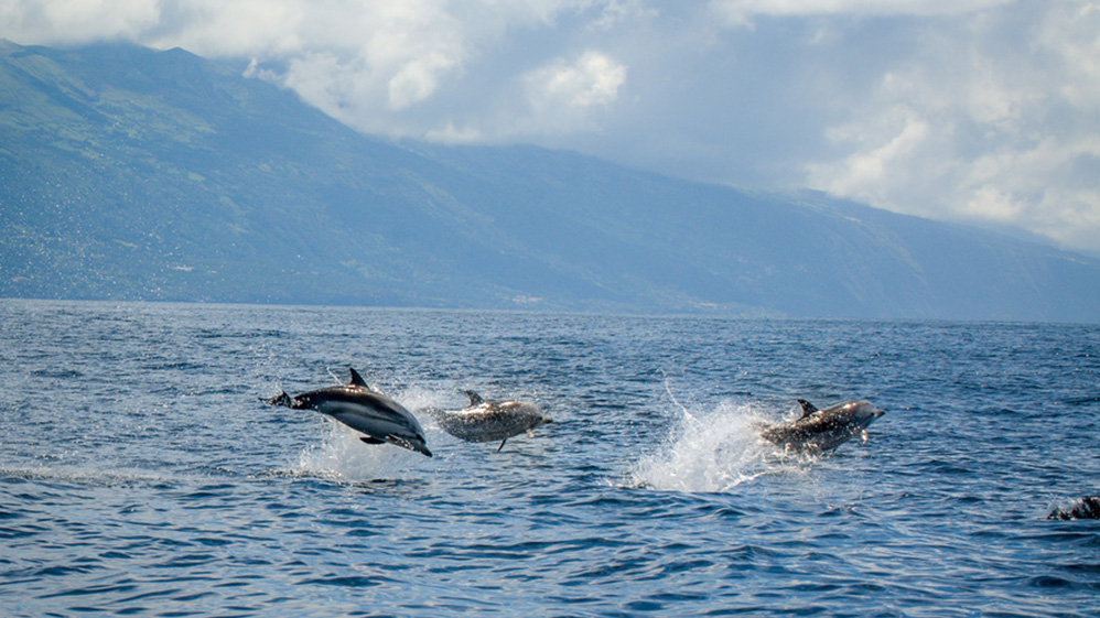
There's so much to do during your stay on Sao Miguel: choose from whale & dolphin watching, diving, deep sea game fishing, walking and much more.
TERCEIRA ISLAND
- The Lilac Island -
(due to the prolific eye-catching lattices of wisteria and lilac.)

Elliptic in shape, Terceira covers an area of 402 sq. kms: it is 29 kms at its longest and 17.5 kms at its widest. The island is a plateau, with the Serra do Cume to the east, the Serra do Labacal in the centre (rising to 808 metres), and the Serra da Santa Barbara (rising to 1,021 metres) to the west.
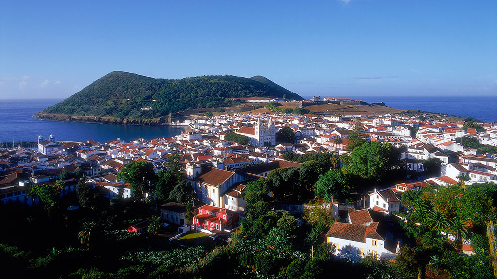
Angra do Heroismo, established in the late 15th century, has been declared a UNESCO World Heritage Site. It is a picture book town of imposing townhouses and cobbled streets seemingly untouched by time. The best views of this once prosperous trading centre are from Monte Brasil across the harbour.
The west coast harbours host villages and the wilderness, with volcanic caves which are a further invitation to discover the subterranean mysteries. Natal Caves and Algar do Carvao, considered a geological Nature Reserve, is formed by caves of up 100 metres in depth, with majestic stalactites and stalagmites and an inner lake.
Praia da Vitoria, to the east, with its sandy beach is a charming small town. The inland offers views from the 500 metres high point of the Serra do Cume, made up of green pastures separated by black volcanic stone walls, which are quite breath-taking.
Terceira caters to all interests from golf, exploring volcanoes, walking, swimming in natural rock pools tovisiting the sixty-eight 19th century ‘Imperios’, (small chapels of the Holy Spirit), which are scattered throughout the island. Then there are the colourful festivals and street bullfights (they pad the bulls’ horns and bulls are never killed) where the only casualty is young men’s wounded pride.
GRACIOSA
- The White Island –
(due to the existence of white coloured rocks)

With an area of 61 sq. kms, Graciosa lies 1.5 hours by ferry north of Sao Jorge and 20 minutes by air north west of Terceira. Oval-shaped, the north and north-east areas are low and flat. The island is 12.5 kms long and 8.5 kms wide at its maximum width.
Pico Timeao, the highest point, rises to 398 metres. Santa Cruz, the main town on the island is peaceful and well preserved with many 18th and 19th century manor houses.
The island’s only black sand beach is at Praia and at Carapacho, the volcanic rocks form a natural swimming pool. In Carapacho there's a well-known spa called Termas do Carapacho.
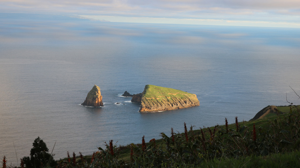
The coastline has many bays and the small off-shore islands provide a sanctuary for the grebe and red-billed tern. The island has fresh fish and shellfish in abundance and is famous for its cakes – in particular the Queijadas da Graciosa – and sweets. The area abounds windmills and vineyards. There is a huge volcanic crater, Caldeira do Enxofre, with lush vegetation and a spectacular lake beneath vaulted rocks in the very heart of the volcano. This is a tranquil island, harder to reach and therefore untouched by time.
Biosphere Reserve in the Island of Graciosa
"The island of Graciosa has served, for over a decade now, as an experimental laboratory for biodiversity conservation and, due to the islands unique natural characteristics, is frequently visited by national and international scientific expeditions. Past and ongoing experiments in resource management, eradication of introduced species and natural habitat restoration, as well as, the existing infrastructures, contribute to the proposed Biosphere Reserve as being an ideal site for executing research projects, natural resource demonstrative and management actions and for training researches and technicians in the field."
From: United Nations Educational, Scientific & Cultural Organization · UNESCO - MAB Biosphere Reserves Directory
SAO JORGE ISLAND
- The Brown Island –
(due to the colour of the rocks of Rosais Islet and Point, the first part of the island one spots when approaching it from the East)

São Jorge is a long (56 kms) and narrow (8 kms wide) island with a total area of 246 sq. kms, which was formed by a series of successive volcanic eruptions. The craggy coastline plunges almost vertically (400 metres in parts) into the ocean with unique, frequent, small fertile flat areas (fajas) at the base of the cliffs. The central platform runs at an average height of 700 metres, rising to 1053 metres at the highest point, called Pico da Esperanca, which offers views of the other islands of central group.
80% of the island is made up of high pasture which supports 20,000 dairy cattle producing high quality milk from which comes the famous Sao Jorge cheese, still manufactured using traditional techniques and the original recipe.
This is an island for walking, for exploring the little settlements on the fajas along the coast by car, for admiring the stunning scenery and visiting the two small port towns of Velas and Calheta. 16 kms across the water is Pico (accessible in one hour by boat) where a 2,351 metres volcano dominates the skyline and seems but a stone’s throw away.
PICO ISLAND
- The Grey Island -
(due to the lack of vegetation on its mountain slopes and extensive volcanic rock coast)

42 kms long and 15 kms wide, with an area of 448 sq. kms, Pico is dominated by its volcano (snow-capped in winter) which at 2351 metres is the highest point in Portugal. The views to and from the volcano are spectacular and its presence seemingly binds together the central islands of Faial, Sao Jorge and Pico itself.
One cannot mistake that this island is volcanic. Between Madalena and Lajes the black stones and rocks have been painstakingly gathered to make the labyrinthine walled enclosures which protect the famous Pico verdelho grape (fortified verdelho wine) which, it is said, was imported in the 16th century from Cyprus. The houses and churches, too, are black – their features outlined in white.
Pico and nearby Faial (30 minutes by boat from Madalena) were the centres for traditional, open-boat whale hunting, an important industry for the islands until its ban in 1987. These two islands are now the centre for the growing interest in whale watching.
Come to marvel at the impressive views and changing facets of the mountain and its relationship with the sea. Visit the fascinating whaler’s museum at Lajes. Walks are plentiful and, for the experienced walker (you must take a guide), the ascent to the summit of the volcano is a must. Also, do not miss the "Gruta das Torres" volcanic caves, the longest lava tubes in Portugal measuring 5150 metres.
FAIAL ISLAND
- The Blue Island -
(due to the number of blue hydrangeas that line roads and pastures, and because of its long-standing association to the sea and all sea related activities)

The five-sided island of Faial has become the resting place of transatlantic sailors. Horta, the main port, has a cosmopolitan and exciting feel and, at bars and restaurants, one hears snippets of sailing stories from around the world. The atmosphere at the legendary Peter’s Cafe, on the harbour-front, encapsulates the very essence of nautical adventure.
The island is dominated by the 1,043 metres cone of its vast Caldeira (volcanic crater, and nature reserve), which is accessed through a tunnel in the cone’s side.
From mid-June to August the island is a riot of blue as the hedges of hydrangeas, originally imported from China and Japan, burst into bloom.
Capelinhos Volcano, considered a landmark in the world of volcanology, is one of Faial's main attractions, where the visitor will be impressed by the effects of the eruption of 1957. It is an area classified as a protected zone of high geological and biological interest.
Horta is an excellent base from which to visit the islands of Pico (all year round with several trips during the day) and Sao Jorge (summer months only). From Horta, there are wonderful and ever-changing views of the volcano on Pico, 8 kms across the water.
FLORES & CORVO ISLANDS
- The Atlantic's Garden -
Flores - Pink Island
(due to its lush azaleas or the colours of the sunset reflected on the Rocha dos Bordoes (a few hundred meters long and well-preserved columns of regular and geometric shape, about 20 metres high) a well-defined prismatic jointing on a mugearite lava flow, about 570,000 years old)
Corvo - Black Island
(due to the fact that it is viewed as a minute "black point" on the horizon, from Flores and its interlacing black stone walls)

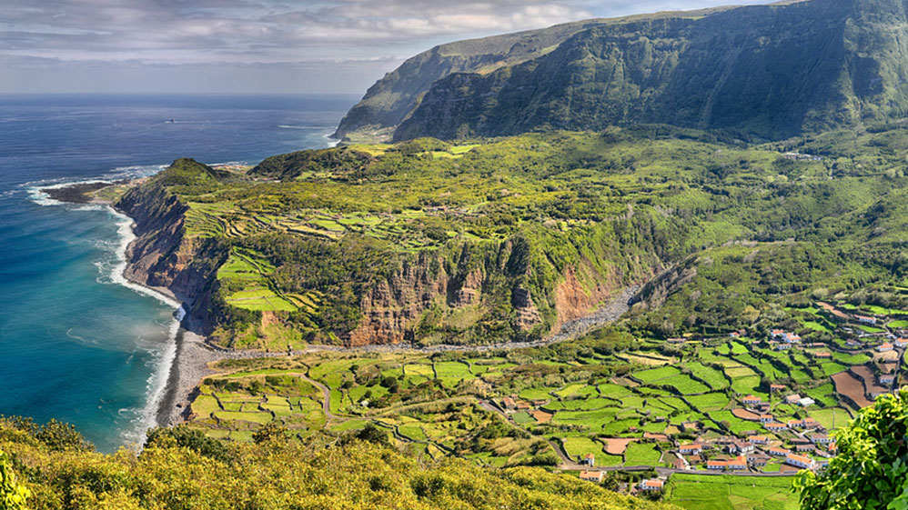
Flores is the most beautiful island, 17 kms long, 12.5 kms at its widest and with a total area of 142 sq. kms. The highest point (Morro Alto) reaches 914 m and offers dazzling views over the lakes and rugged valleys. At the westernmost extremity of Europe, Flores is difficult to reach in winter when it bears the brunt of the Atlantic gales.
This island is spectacular, with craggy cliffs, a multitude of lakes and craters, high waterfalls, small pastures bordered by mile after mile of hydrangea hedges, stunning views and unique, spectacular shades of green.
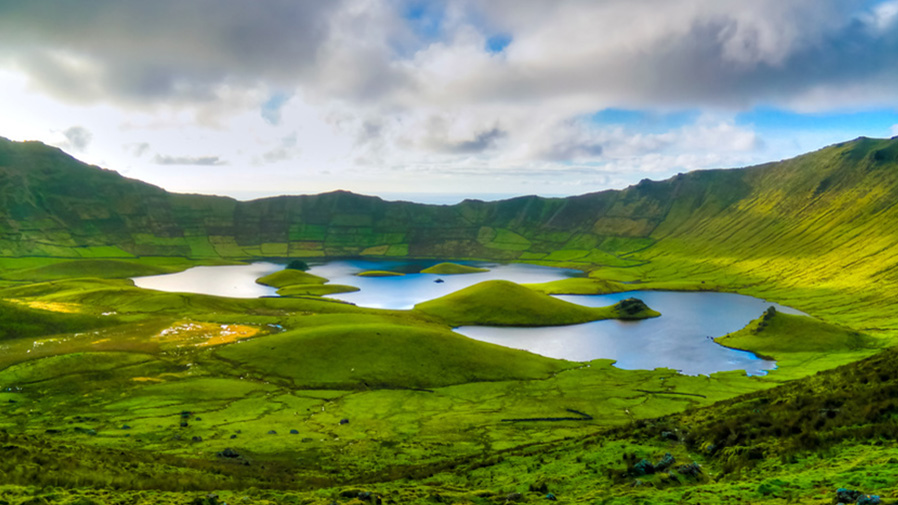
Take a 3.5-hour boat trip around the island, tour the island by car hire or taxi, dive, visit neighbouring Corvo (approximately 45 minutes by a rigid hull inflatable boat depending on ocean conditions) or just walk. Corvo, across the water, is the remotest and smallest of the islands, being 6.5 kms long and 4 kms wide. There is one tiny settlement – Vila Nova do Corvo and, six kilometres uphill from the village, is the vast (300 metres deep and 2 kms wide) green, volcanic crater of the Caldeirao, reached by a wonderful walk which offers views of green pastures, the oceans and Flores across the water.
Biosphere Reserve in the Island of Flores & Corvo
Previous and ongoing research projects in the proposed Biosphere Reserve have taken on a multi-disciplinary and integrated character. Many of the scientific works developed on Corvo are linked to regional research and management projects that attempt to characterise ecosystems and aspects of human resource use. These projects aim at developing coherent management systems and topics range from geological classification and dynamic studies to the biology and ecology of locally important species, also covering socio-economic and cultural aspects.
From: United Nations Educational, Scientific & Cultural Organization · UNESCO - MAB Biosphere Reserves Directory